

Delighted to announce our new schedule for the summer.
Another hike up Benbulben 1st April 2017

A window of opportunity - Guided hike up Benbulben Saturday 25th March 2017
We headed up Benbulben this morning in glorious sunshine. Such a contrast to the St Patrick's weekend festival hike when visibility was down to zero due to heavy rainfall and hill fog. Today was wall to wall sunshine throughout the entire hike and we were rewarded by stunning views throughout Sligo and Donegal. We even caught a glimpse of Croaghpatrick in Mayo.


"A window of opportunity" Guided Hike up Benbulben Sat 1st April 2017
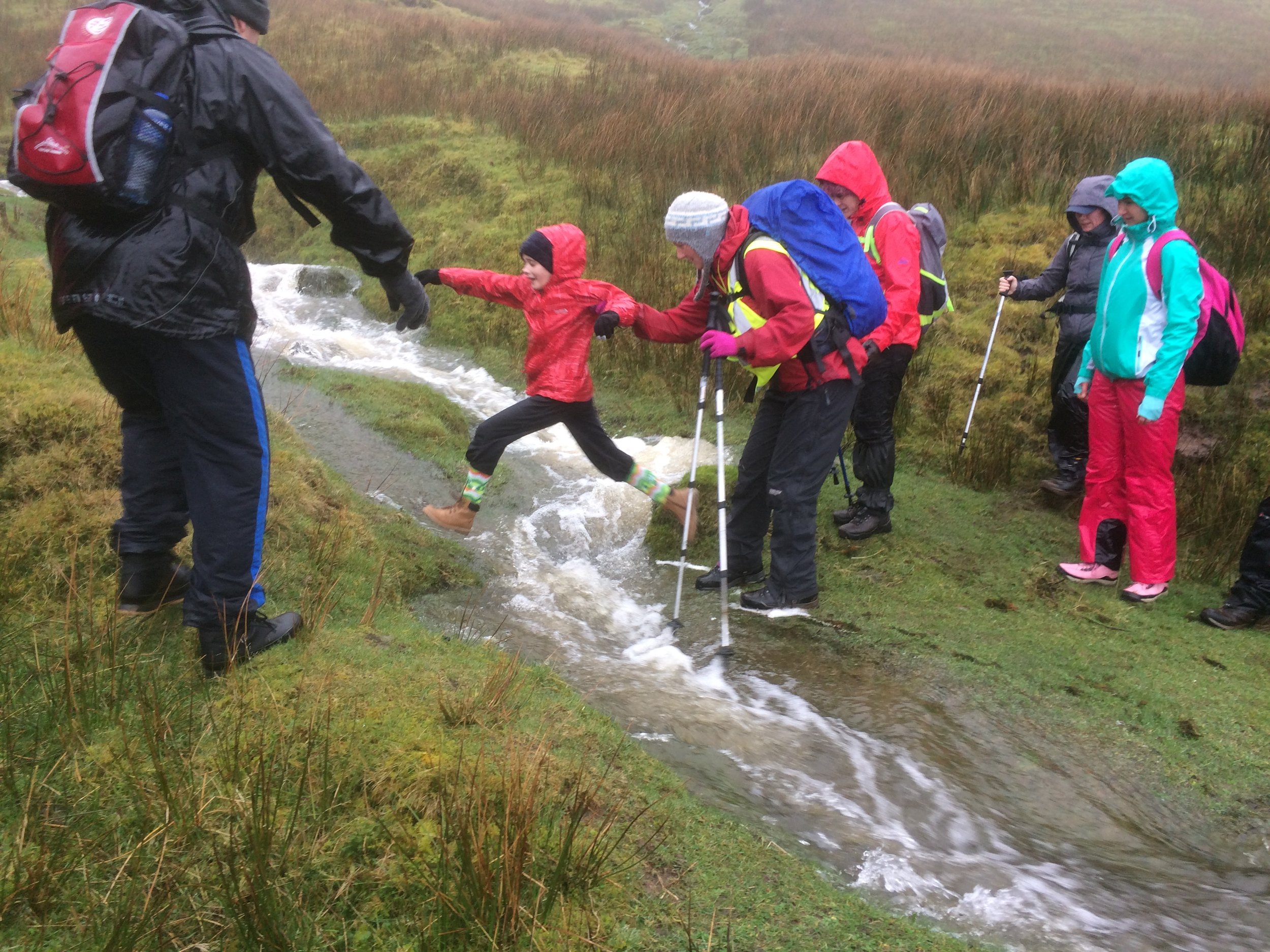
"A leap of faith for Sophie" - Hiking up Benbulben
"Hold the high note" - Guided hike up Benbulben 18th March 2017
This morning was a difficult call. Do we cancel the hike up Benbulben or not. The forecast suggested a rather damp day with light rain and moderate winds but mild. They got it fairly right apart from the "light". Decided to proceed with caution and not disappoint all those who had traveled long distance to participate.
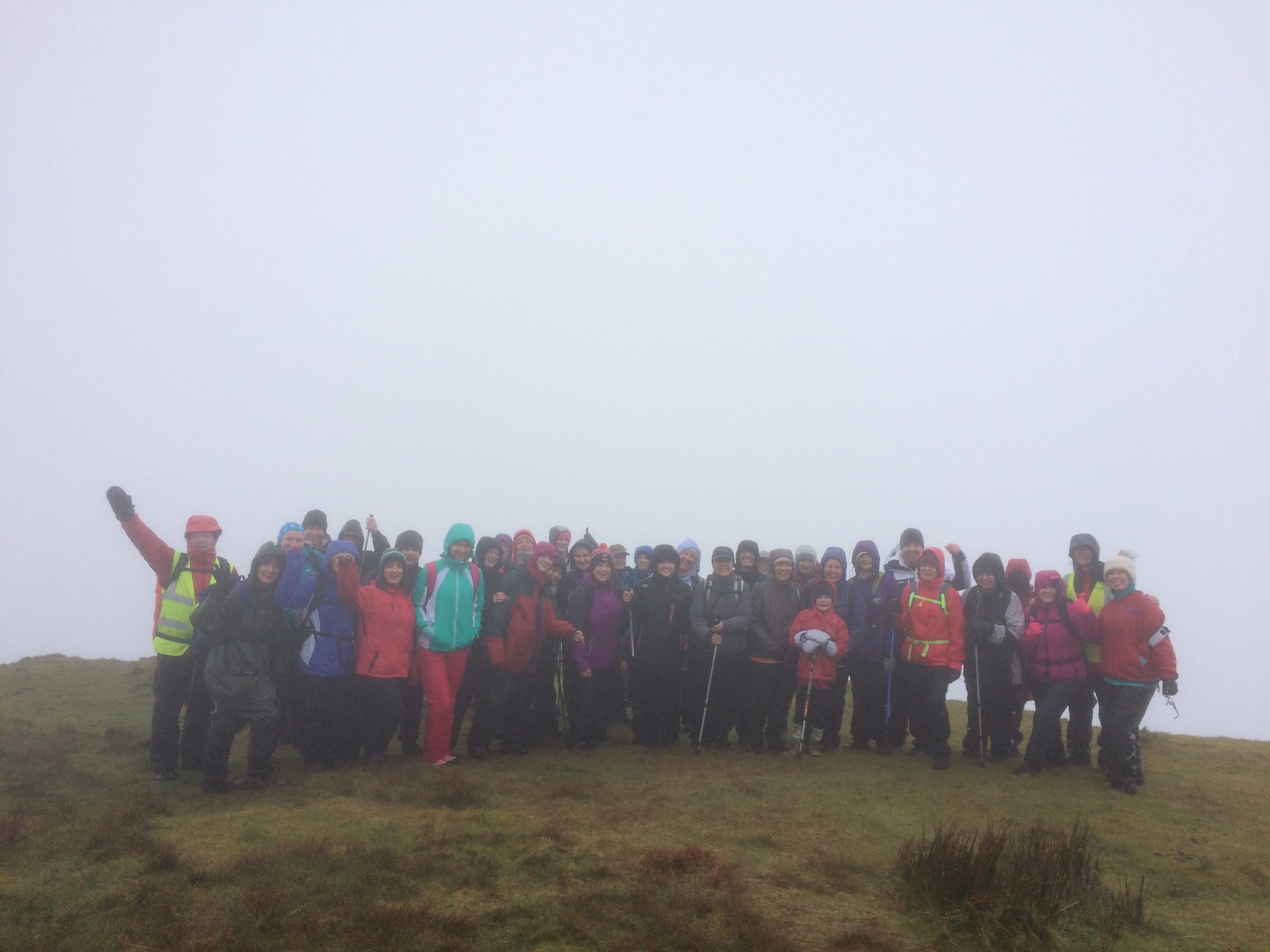
I have to sincerely thanks 36 people who braved the elements and won out in the end when they could so easily have opted out. There was the odd slip and slide even at the front also. No one escaped, but all down safely in the end. Lots of happy faces although wet through. The constant rain did not dampen the enthusiasm and lots of intent to return and do it again albeit on a better day weather wise.
Upcoming event schedule - please follow the link to view
https://www.facebook.com/highhopesmountaintreks/events/?ref=page_internal
Event Schedule update. We are delighted to announce our updated event schedule between now and the end of May. Please visit the event page and we feel sure you will find a guided hike suitable for you. Already the hike up Benbulben on the 18th March and Nephin on the 22nd April are fully booked out.
There are spaces available on the other hikes published.
We are not planning any additional events until we commence our new calendar from June onward.
However we are available to organize hikes for small groups (minimum of 5) on request
Valentines Weekend Special Hiking Event - "Love is in the air"

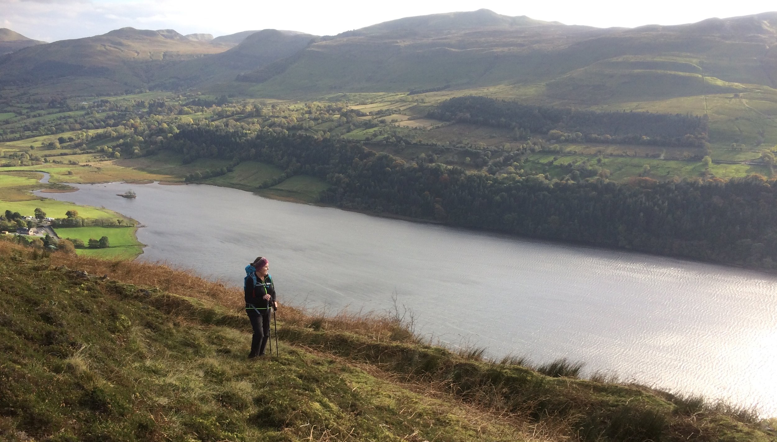
Happy group of hikers enjoying the stunning scenery high above the Glencar Valley and Lake.
11th February 2017 Valentines Weekend Special - "Love is in the air" Guided Hike
Come along and enjoy hiking to one of the most scenic locations Sligo has to offer.
Following on the success of our New Years High Note event we are now creating a hike on a different note.
The theme of this guided hike is one of stunning scenery and a truly romantic location.
Why not treat your loved one to a special present for Valentines weekend.
The Route.
We will commence our hike at Glencar waterfall and ascent the Old Bog Road. The route will continue along the escarpment high overlooking Glencar Lake and the Castlegal Mountain range across the Valley.
We will pass the ruins of an ancient shepherds hut alongside a tumbling stream. Soon we reach the top of a waterfall known as The Devils Chimney. This waterfall is listed as the tallest in Ireland. It is called "Sruth In Aghaidh An Aird" meaning "The stream against the height". On various occasions the flow of the waterfall blows upward due an updraught of air. We might get to witness this if we are lucky on the day.
The hike continues to the high cliffs of Toormore where we will stop for lunch at a location known locally as "Hard Rock Cafe". From here we will have an overview of a unique glaciated location of the Swiss Valley which hosts an array of alpine plants.
Our return route follows back along the escarpment and down to lake.
Finally we will enjoy Tea/coffee and cake in the newly developed Glencar Teashed.
The hike will take approx. 4 hours to complete at a gentle pace.
Difficulty level: Moderate. Well within the reach of good regular walkers.
Distance: 9 kms
Height Gained: 300m
OSI Map: 16
Cost: €25 including Tea/coffee and cake in Glencar Teashed.
Early booking is recommended as it is expected this event will be fully subscribed soon.
Pre registration is essential to avoid delays on the day.
To book and register on this hike please email us at: highhopesmountaintreks@yahoo.com
or call us at: 086 3454045
or use the online enquiry form to apply
Registration will take place at 9:30am on the morning at the Glencar waterfall car park.
Equipment required:
Good waterproof boots and waterproof clothing are essential; hiking trousers are advised, (no jeans please); spare warm layer; hat and gloves; lunch and/or snacks; water or juice drink, (1.5 litres); small rucksack to carry it all in.
For full details please visit us on our web site:
http://www.highhopesmountaintreks.com/
The Mourne Mountains Co Down.
Enjoyed exploring some of the lower peaks at the southern end of the Mournes Mountains yesterday. Started at Kilbroney Park near Rostrevor. The well developed trail serves as hiking and mountain biking facility. At the top of the trail we hiked on to open mountainside visiting Slieveban, Slievemeen and Slieve Martin. The highest point reached was 485m. The views across Carlingford Lough are stunning with Slieve Foy dominating the landscape the other side of the Lough. This part of the mournes are more gentle in gradient than the more northerly higher peaks. However it is still a rewarding day out.
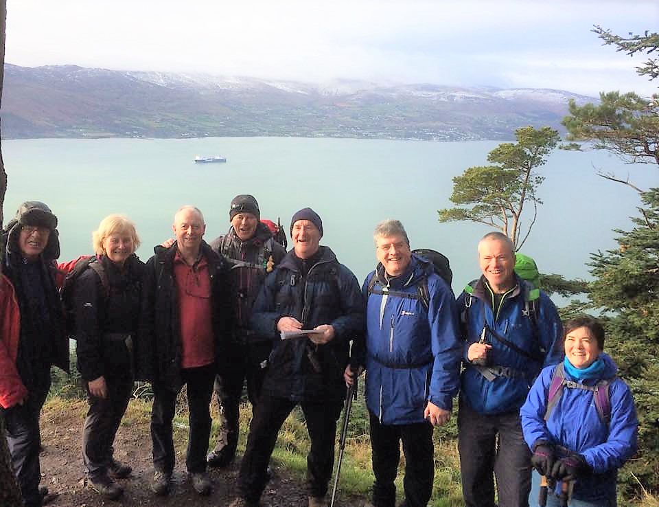
Great views overlooking Carlingford Lough
"Ring in the new year on a high note" Hike up Benbulben January 2nd 2017

On Monday the 2nd January 2017 a group of 49 hikers climbed Benbulben on a beautiful clear day with lots of winter sunshine. All enjoyed the stunning views and great craic. A great way to blow away the winter blues and we wish all a Happy New Year.
Start the new year on a high note with a guided hike up Benbulben
High Hopes Hiking is providing an opportunity for a guided hike up Benbulben on Monday the 2nd January 2017.
What better way to ring in the new year.
Hiking has been shown to have huge advantages to health of body mind and soul.
The meeting point for this hike is Drumcliffe Church car park at 10 am. From here its a short drive to the start of the hike at Luke's Bridge. The hike will last between 4 to 5 hours
This hike is suitable for most reasonably fit walkers. The height gained is approx 400m.
Cost €20 pp.
Equipment required:
Good waterproof boots and waterproof clothing are essential.
Hiking trousers are advised (no jeans please).
Spare warm layer, hat and gloves, lunch and/or snacks, water or juice drink (1.5 litres),
Small rucksack to carry it all in.
First snow of the winter arrives on Benbulben.

Enjoyed a lovely hike up to Slievemore on Kings Mountain, Benbulben this morning.
Summer Time Ends Sunday 30th October
Since the clocks go back this weekend, suddenly the Sunday evening sunset will arrive significantly earlier. It's easy to be caught out. So to help, let's shine a light on some steps you should take to avoid being unexpectedly out in the dark on the hills.
In Ireland and the UK, the clocks go back one hour at 2am on the last Sunday in October, which is 30 October this year. It's probably no coincidence that it’s also the time of year when many mountain rescue teams report an increase in callouts to ‘no torch’ incidents! Basically, people forget how early the sun goes down, forget to take a torch, then get caught out by darkness falling and can’t find their way off the hill or mountain.
It’s unfortunate because search operations cost hundreds of pounds and many hours of volunteers’ time. Careful planning, appropriate equipment, and knowledge of some basic but essential skills will help you avoid a night-time epic and the prospect of having to call for assistance. Here's nine ways to avoid it:
What you should do
1. Check sunset time and weather forecast
Even if you know what time sunset is, it may get dark much earlier than expected if there’s a lot of cloud cover, and unanticipated bad weather can delay you and catch you out!
2. Plan your route
Don’t know where you’re going? Then you probably won’t know how long it’ll take you to get off the hill. Make sure you have at least the bones of a plan before you set off
3. Pacing
Don’t overestimate how quickly you think you can walk over long distances, especially if you don’t have much experience. It’s always better to underestimate! Be realistic about your fitness levels, the terrain, and the amount of time your route will take you.
4. Lighten up!
You can never have enough torches; in fact, everyone in a group should have their own, even if you expect to be back before nightfall. And don’t forget to pack spare batteries!
5. Get kitted up
Make sure to carry other appropriate equipment, including spare warm clothing and a whistle for summoning help.
6. Know your navigation
Don’t get lost! Carry a map and compass, and know how to use them. It’s tempting to just leave it up to your phone, but try not to rely solely on smartphone apps for navigation
7. Always go full-bar
Before you leave, make sure your mobile phone is fully charged. And keep an eye on how much battery is left before you take too many photos and drain it dry. You can’t call for assistance with a dead phone.
8. Drop a pin
If you’re about to get benighted, check your surroundings and plot your exact position while you can still see landmarks. Then take a compass bearing and follow it to make sure you know where you’re going.
9. Who you gonna call?
Calling for assistance should be the last resort, but don’t leave it too late if you are in trouble; emergency services can’t help if they arrive too late.
Sending for help
If you are unlucky enough to require emergency assistance in the hills or on inland crags, call 999 or 112 and ask for Police – Mountain Rescue, even if you are at a roadside crag, as ambulance staff are not trained or equipped to go off road or scrambling up cliffs.
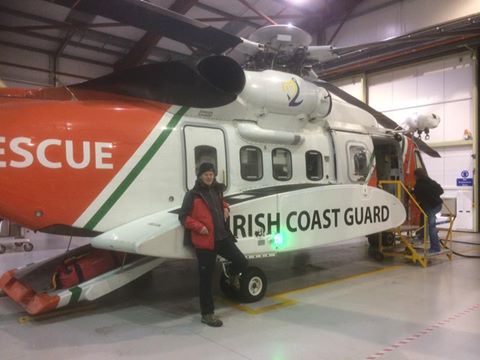
Visit to the Coastguard Helicopter Rescue Base
The Irish Coast Guard has contracted five medium-lift Sikorsky Search and Rescue helicopters deployed at bases in Dublin, Waterford, Shannon and Sligo. The helicopters are designated to be in the air from initial notification in 15 minutes during daylight hours and 45 at night. We hope that we will never need to call on them but it is reassuring to know that in an emergency they are on standby 24 hours per day.

"The dope on the rope"
"The Sounds of Music" on Benbulben with High Hopes Hiking
"The Sound of Music" on Benbulben Head
Back on Benbulben today
Had the pleasure of guiding four beautiful young ladies from America and Canada to the top of Benbulben this morning. Thankfully the wet weather conditions didn't dampen their spirits and they even manage to break into song on Benbulben Head. Congratulations and well done and hope when you return home the memories of this morning will remain.

Guided Hike on Benbulben
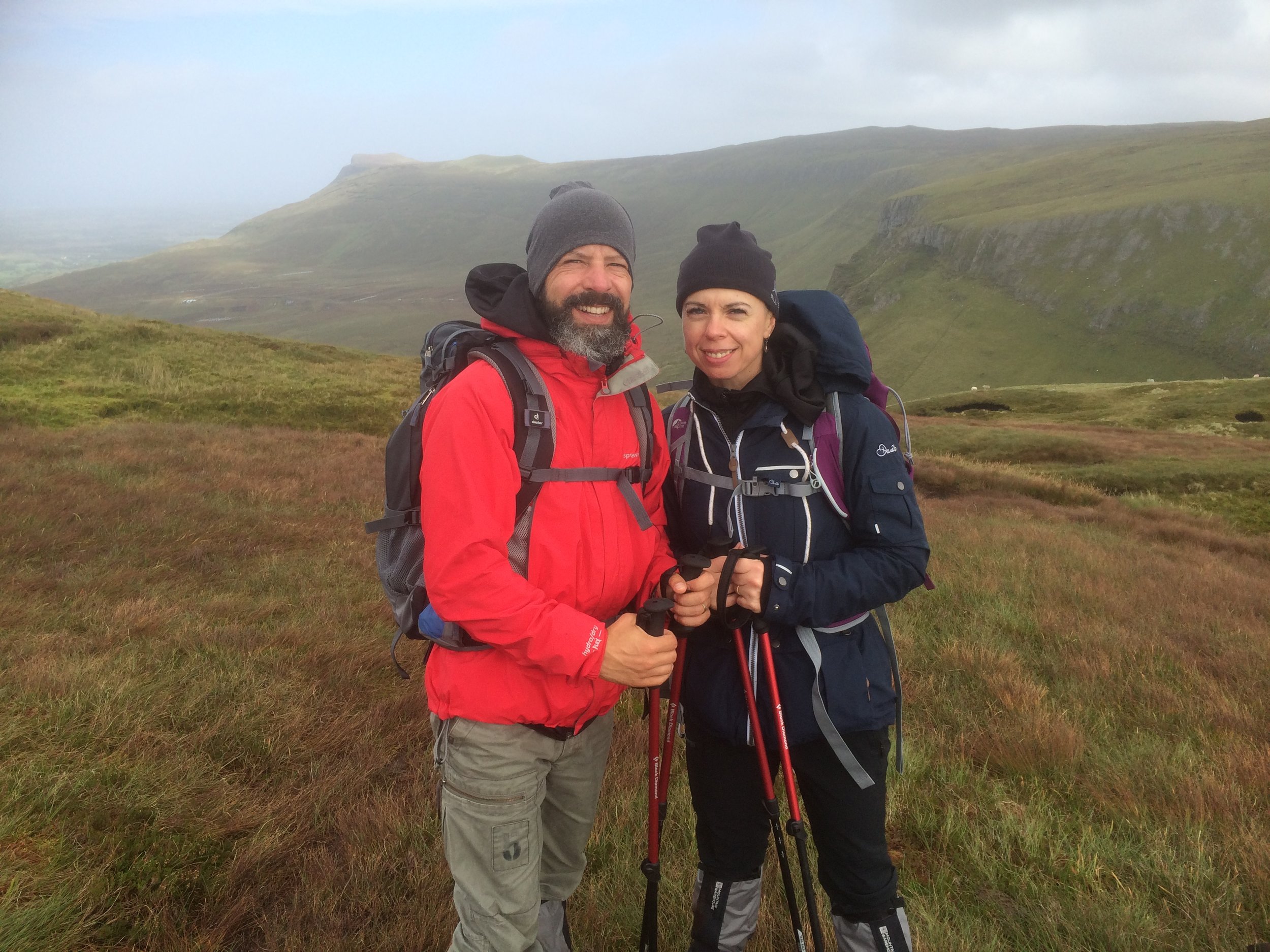
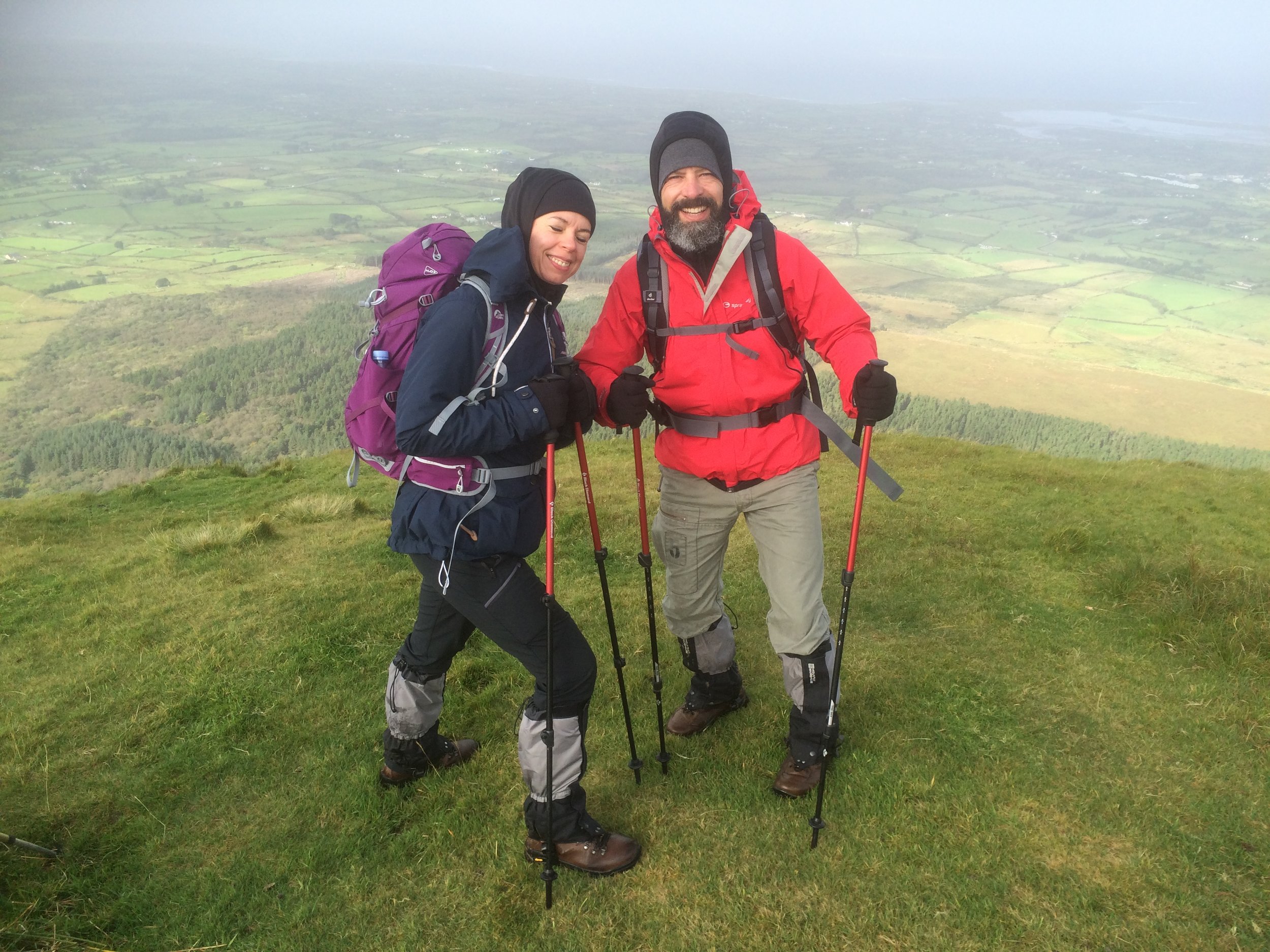
Delighted to have Tomasz and Agatha with us today. Glad the weather was favourable too and we could complete the hike with out a drop of rain. We had some great chat and wonderful scenery. Thanks for choosing High Hopes Hiking and we look forward to seeing you soon again.
Bit windy on Benbulben Head but the sun was shining and we are all happy :)
Hiking In The Sheefry Hills Co Mayo
Great day out yesterday on the Sheefry Hills Co Mayo. A real mixed bag of weather didn't deter the hardy group of hikers. Started in sunshine which soon turned into hail and strong winds. Towards the end of the hike the rain came down in earnest and we got thoroughly drenched. The spirits stayed high and with the good visibility we enjoyed some great scenery over Mweelrea, and the surrounding mountains.
